HIGHWAYS AND ROADS
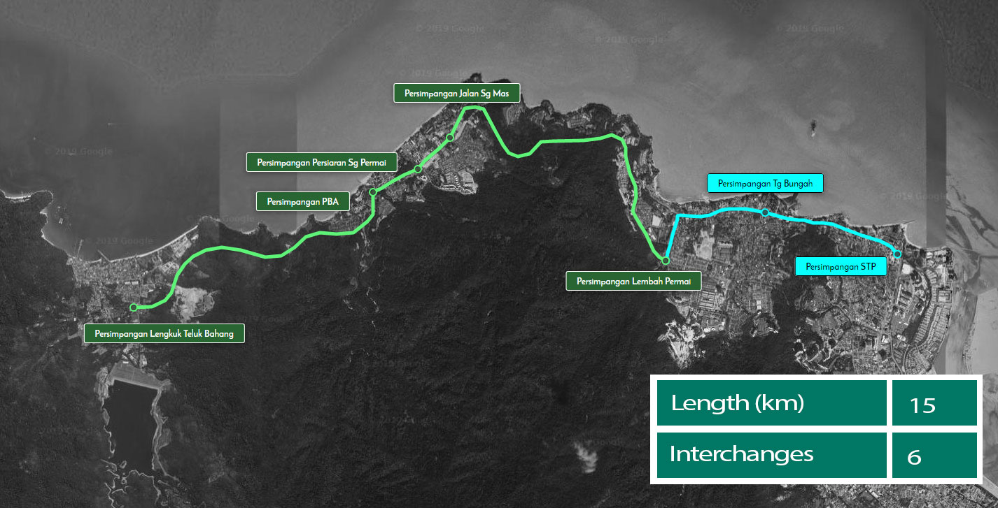
North Coastal Paired Road (NCPR)
The Penang Transport Master Plan reflects the Penang State Government’s commitment in addressing the needs of the people. Among its main objectives is to provide an efficient and reliable public transport system complemented with efficient road network and connectivity.
Two major players have been tasked by the Penang State Government to undertake the project under PTMP, namely SRS Consortium and Sdn Bhd and Consortium Zenith Construction Sdn Bhd.
The highway master plan developed by SRS Consortium for PTMP outlines strategic traffic bypasses to cater for the rising vehicle numbers, particularly with foreseeable major developments taking place over the next decades; and to provide long-term relief from congestion.
The Tun Dr Lim Chong Eu (LCE) Expressway is presently the only key north-south spine road on Penang Island. It has to cater for additional traffic demand from newly constructed infrastructure such as the Second Penang Bridge, the planned airport and industrial zone expansions, as well as simultaneous developments on the eastern coast.
However, it has become severely congested, having outgrown its intended design capacity. Without long-term intervention measures, the LCE’s condition will continue to deteriorate, and impact Penang’s future growth and liveability.
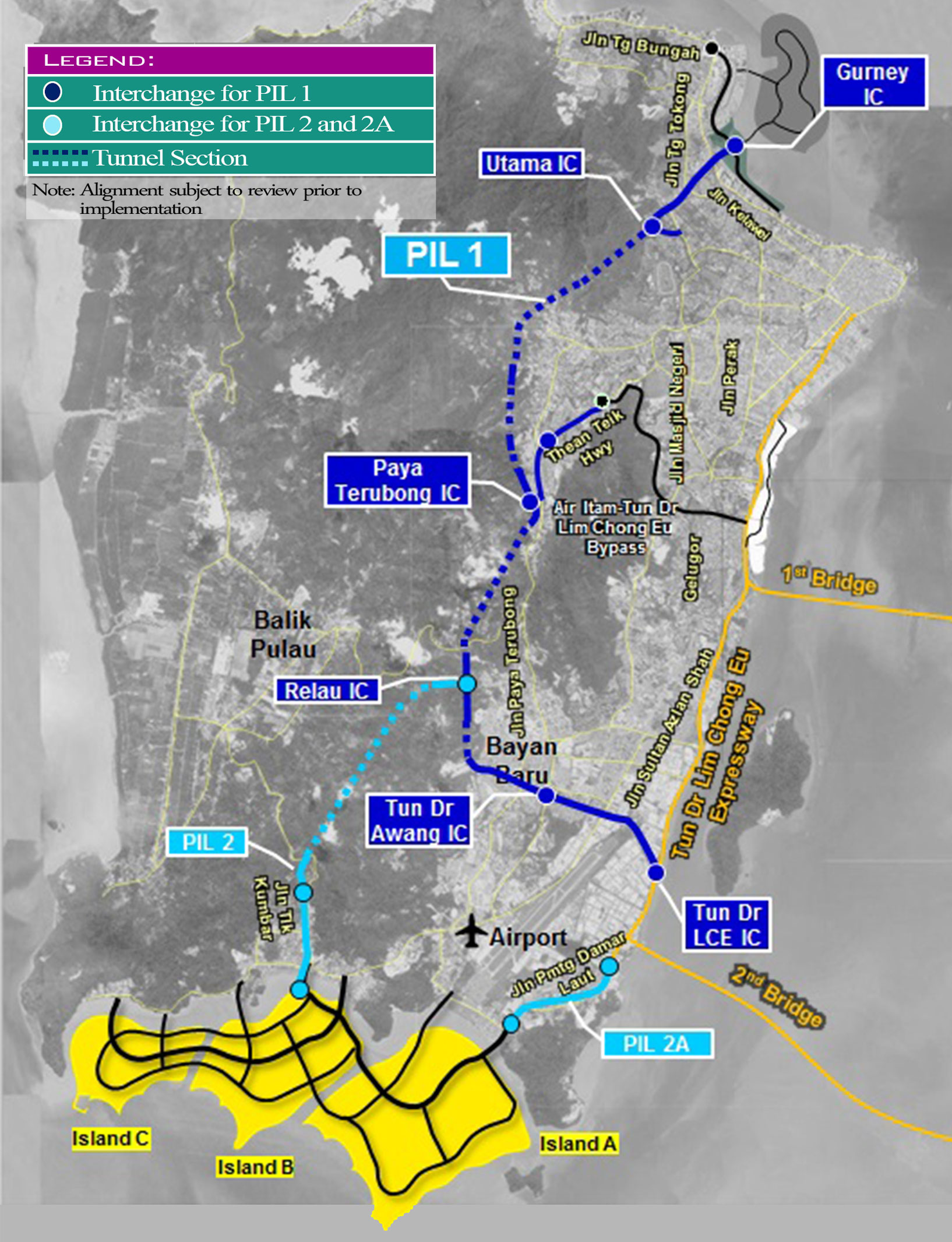
The master plan proposes a second spine road to ease the congestion on LCE. The Pan Island Link 1 will provide a ring traffic dispersal system connecting the North Coastal Paired Road (NCPR), Gurney Expressway, LCE, Penang International Airport and the first and second Penang Bridges.
There will also be interchanges at several strategic locations for traffic dispersal, namely in Gurney, Persiaran Kuari, LCE, Tun Dr Awang and Paya Terubong.
For Penang Island, the master plan proposes the construction of:
| Proposed new roads / highways | Approximate Length (km) | Number of Interchanges (IC) | |
|---|---|---|---|
| 1 | PIL 1 | 20 | 6 (including Relau IC) |
| 2 | PIL 2 | 8 | 2 (excluding Relau IC) |
| 3 | PIL 2A | 3 | 2 |
| 4 | North Coastal Paired Road (Package 1) | 9.6 | 4 |
| 5 | Ayer Itam – Lebuhraya Tun Dr Lim Chong Eu bypass (Package 2) | 6 | 3 |
| 6 | Persiaran Gurney – Lebuhraya Tun Dr Lim Chong Eu bypass (Package 3) | 3.95 | 3 |
| TOTAL | 50.55 | 20 | |
For Seberang Perai, the proposed plan includes the:
| Proposed new highways / roads | Length (km) | No. of Interchanges | |
| 1 | Butterworth-Kulim Expressway interchange upgrading | 1 | |
| 2 | Juru interchange upgrading | 1 | |
| 3 | Missing Links (local network): Permatang Pasir-Perda | 7 | |
| 4 | Missing Links and Upgrading Links (local network): Bkt Minyak area | 2 | |
| TOTAL | 9 | 2 | |
| GRAND TOTAL | 44 | 15 | |
The combined length of all the proposed highway and road projects under the masterplan is 44km with a total of 15 interchanges.
These components are still at proposal stage and subject to approval and changes in the future. Only the PIL 1 component has obtained environmental impact assessment approval.